The actual wooden wall map used on D-day, showing the shipping lanes, set for D-day at H-hour, in the map room at Southwick House, England, September 2017 (Photo: Sarah Sundin)
Wednesday, February 7, 2018 by Sarah Sundin
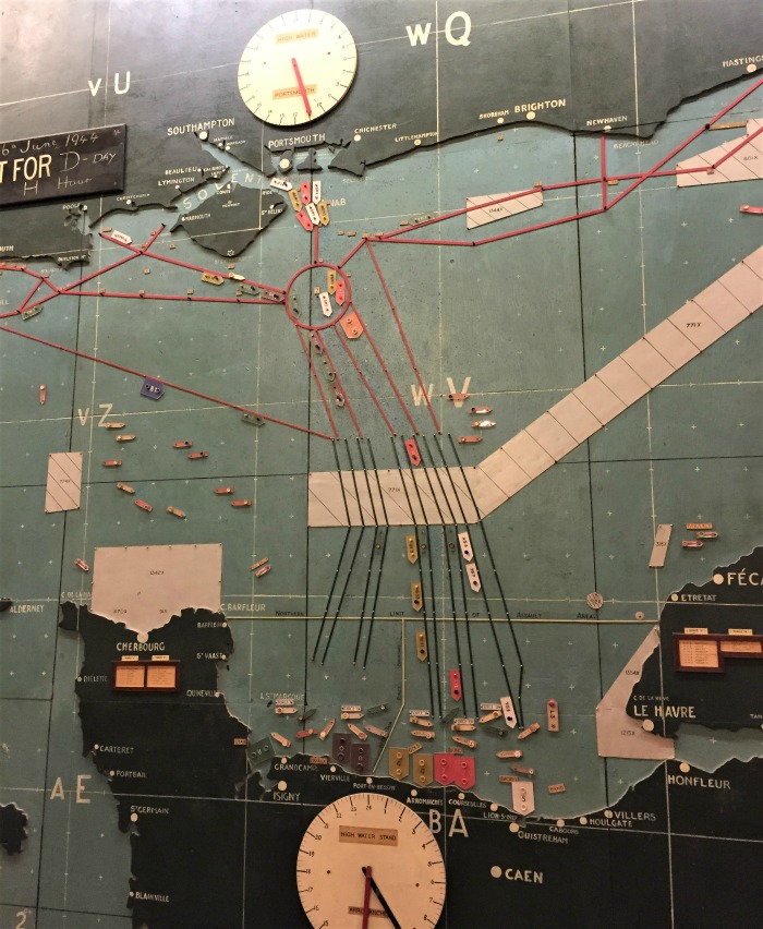
The actual wooden wall map used on D-day, showing the shipping lanes, set for D-day at H-hour, in the map room at Southwick House, England, September 2017 (Photo: Sarah Sundin)